Drones tend to get a bad press, mainly perceived by the public as remote killing machines in an increasingly de-humanised version of war.
But drones, also known as unmanned automated vehicles (UAVs), came to Oxford last week with a very different purpose – showing environmental researchers a new and cost-effective way of mapping forests.
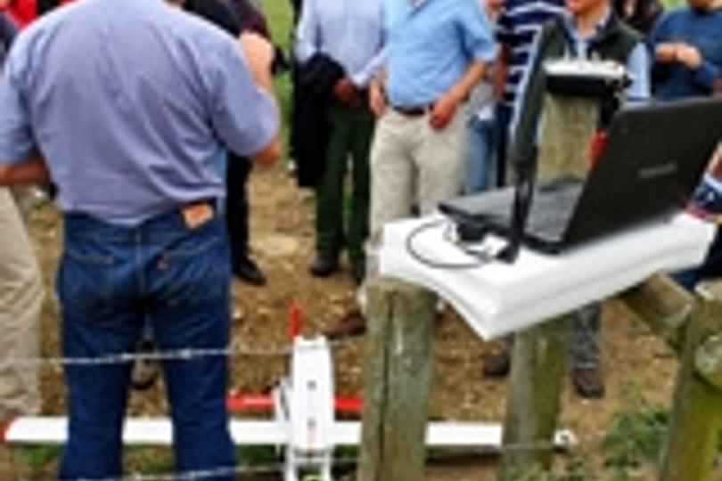
Professor Yadvinder Malhi, director of the Oxford Centre for Tropical Forests, set out for Wytham Woods with colleagues from a range of departments across the university, and also environmental consultants from the Oxford area, to watch the maiden drone flight over the tree canopy.
The centre – which was set up with funding from the Oxford Martin School – is monitoring Wytham as part of a global network of forests being studied for the effects of climate change, in collaboration with partners such as the Smithsonian Institute and Earthwatch.
The drone, a model named Maja, was brought over by academics from the Swiss Federal Institute of Technology in Zurich and Swiss company ResearchDrones, who were keen to show their technology to leading academics at the world-renowned research site.
Drone technology may mean that vital research into remote ecosystems can be carried out much more cheaply in the future, said Professor Malhi.
“At the moment we use manned aircraft firing lasers to get a picture of the structure. That’s big technology and those flights cost £20-30,000.
“These drones cost less than £3,000, so in principle that’s a much cheaper way. Now we want to evaluate what they’re useful for and how useful the information is that they collect.
“We’re thinking of buying some and maybe taking them out to sites in Peru.”
The drones could also be used to track animal movements, he said.
“We use radio collars but you currently you can’t receive the signal unless the animal is nearby. But if we’re flying over we could pick up the transmissions. It could really advance conservation studies.”
The lightweight craft – made mostly from foam and weighing just 3kg - are launched by hand, and can be controlled both by co-ordinates programmed into a computer and by remote control, as with model aircraft. And the code that is used to programme the drones is open source so students can access it and work out how to develop it.
The drone was fitted with two cameras; one filmed continuously while the other took still photographs every three seconds.
Unfortunately the demo of the Maja came to a premature end when it crashed to the ground, damaging its motor.
“We don’t know why it happened but it’s all part of the adventure of exploring these new technologies,” said Professor Malhi, who is now looking forward to assessing how the images recorded during the flight could be used. “Perhaps it’s the Bermuda triangle of Wytham.”